Deadhorse, Alaska
WELCOME TO WWW.DEADHORSEALASKA.COM
|
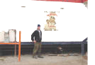 Prudhoe Bay (Deadhorse) Alaska is home to the largest oil field in North America. It is located in Alaska between the coast of the Beaufort Sea and the North Slope of the Brooks Range Mountains. It is about 1200 mi. south of the North Pole and 250 mi. north of the Arctic Circle. Arctic drilling rigs differ from their southern counterparts in that they generally are more self contained. As is evident by the picture the rigs are enclosed to protect it and the workers from the Arctic Winters. Many of the rigs can be transported from drill site to drill site without any disassembly. Many rigs have a camp house that moves with the rig to provide room and board for the workers. Other wildlife in the area: Arctic Fox, Arctic Ground Squirrels, Grizzly Bears,
 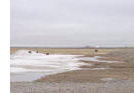 Polar Bears, Musk OX, Arctic Hares, Caribou (Approximately 25,000)and over 200 different bird and waterfowl species including geese, swans, seagulls and eagles . During the winter months only the arctic fox, ravens, and the occasional polar bear are to be seen. Ice roads are built during the winter months to reduce the damage to the environment for access to
  remote drill sites. conditions need to be twenty below zero or less for construction thus limiting exploration drilling to the Winter months in most cases.
|
|
Located on the Arctic Ocean, Utqiagvik/Barrow is one of the largest Eskimo settlements in Alaska. It’s also the farthest-north community in the United States. Its extreme location means Utqiagvik/Barrow receives 24-hour daylight between sunrise on May 10 and sunset on August 2.
ABOUT BARROW
Utqiagvik/Barrow is one of the oldest inhabited town sites in the United States, and archaeological evidence of human habitation in the area goes back to 800 AD. In the Inupiaq language, Utqiagvik/Barrow is called Ukpeagvik, which means “the place where we hunt snowy owls,” but that’s just one of the species that have provided nourishment to local people for thousands of years. Hunting and gathering is still a big part of life in Arctic Alaska, and seasonal hunts for whales, seals, walrus, caribou and ducks remain important for both traditional and economic reasons. Today, Utqiagvik/Barrow serves as a hub community for smaller outlying villages, and its population of more than 4,000 residents makes it one of Alaska’s larger villages.
THINGS TO DO
The Inupiat Heritage Center offers visitors the opportunity to purchase arts and crafts such as baleen boats, etched baleen, carved ivory, masks, parkas and fur mittens. If you time your visit right, you may also get to witness the local men embark on their annual whale hunt. A whaling captain directs crews of hunters, and if the whalers are successful, there is a festival called Nalukataq when the season ends in May. Hunters share whale meat and sections of skin and blubber known as muktuk with the entire community.
During the summer months, tour operators offer package tours of the area that can include viewing polar bears, photographing snowy owls or learning about the North Slope’s traditional culture. Other sites on the National Register of Historic Places are the Cape Smythe Whaling and Trading Station in nearby Browerville and the Birnirk archaeological site approximately two miles north of the Utqiagvik/Barrow airfield. Cape Smythe was built as a whaling station in 1893 and is the oldest frame building in the Arctic. The Birnirk culture, which existed about 500-900 AD, is represented by a group of 16 dwelling mounds and is considered a key link between the prehistoric cultures of Alaska and Canada.
The Will Rogers and Wiley Post Monument, dedicated in 1982 to commemorate the 1935 airplane crash of the American humorist and the famous pilot, is located across from the airport. The accident occurred 15 miles southwest of Utqiagvik/Barrow, a planned stop on their trip from Fairbanks to Siberia. Two monuments, both on the National Register of Historic Places, are located where the men died.
WISEMAN
Located just three miles off the Dalton Highway and near the boundary of Gates of the Arctic National Park and Preserve, Wiseman is a jumping-off point for properly equipped backpackers who want to trek into the park on foot.
ABOUT WISEMAN
Today less than two-dozen people live in Wiseman, a century-old mining town that enjoyed its heyday in the 1920s. Thirty cabins from the gold rush era are still used today, mostly by seasonal residents. It can get cold here in the winter; easily dropping to minus 70 degrees Fahrenheit.
THINGS TO DO
Wiseman’s scenic settling along the Middle Fork of the Koyukuk River and against the backdrop of the Brooks Range give you a sense for its recreational options. Hiking, fishing, river rafting or float trips, bird watching and wildlife viewing are excellent in summer. In winter, cross-country skiing, snowshoeing, dog mushing and most notably, northern lights viewing, are excellent.
alrus Festival is held each spring.
Despite its status as the smallest incorporated city in Alaska, Bettles is the gateway to big expeditions in no less than four major federal parks/land areas, not to mention phenomenal winter adventures.
ABOUT BETTLES
Bettles/Evansville consists of two villages with about 30 residents each. Bettles is the major departure point to the Gates of the Arctic National Park, Kobuk Valley National Park, Noatak National Preserve, Kanuti National Wildlife Refuge as well as the Central Brooks Range.
THINGS TO DO
Bettles is known for its wilderness lodges and camps specializing in adventure and fishing packages. Travelers can expect experienced Alaska guides and outfitters. Independent hikers and anglers can seek out the ranger station just beyond the airstrip at Bettles for Gates of the Arctic National Park and Kanuti National Wildlife Refuge information. It is open daily in summer with information and resources relating to the park.
Scenic Anaktuvuk Pass is located in Gates of the Arctic National Park and Preserve, between the Anaktuvuk and John rivers.
ABOUT ANAKTUVUK PASS
Inaccessible by road, this remote village is the last remaining settlement of the Nunamiut Eskimo, a once nomadic band who shadowed the caribou migrations.
Wildlife in the area includes caribou, moose, grizzly bears and a variety of birds. Residents who hunt and trap for food and to sell the skins also offer guiding services to visiting hunters.
THINGS TO DO
Simon Paneak Memorial Museum focuses on reviving and preserving the history of the Nunamiut. Exhibits present the early natural, geological and cultural history of the Anaktuvuk Pass area, including the migrations of people across the Bering Land Bridge. Traditional clothing, household goods and trapping and hunting implements are on display. A number of day tours operating out of Fairbanks offer a stop at Anaktuvuk Pass.
Kotzebue lies at the tip of a gravel spit that reaches into Kotzebue Sound in Alaska’s Northwest Arctic region. Its location near the drainages of the Noatak, Kobuk and Selawik rivers make it a transportation and supply hub for villages that lie along these rivers to the east.
ABOUT KOTZEBUE
Situated 26 miles north of the Arctic Circle, Kotzebue provides access to some of the finest river running in Arctic Alaska due to its proximity to the Noatak, Kobuk and Selawik rivers. Shore Avenue, Kotzebue’s main drag, is a narrow gravel road only a few yards from the water at the northern edge of town and offers views of salmon drying out on racks, fishing boats crowding the beach to be repaired and locals preparing for the coming winter. This is the optimum place to watch the summer’s midnight sun roll along the horizon, painting the sea reddish gold in a beautiful scene of color and light reflecting off the water. Beginning in early June, the sun does not set for about six weeks.
THINGS TO DO
The National Park Service operates a facility in Kotzebue year round and provides information on nearby Noatak National Preserve, Kobuk Valley National Park and Cape Krusenstern National Monument.
Kotzebue has one of the largest communities of indigenous people in the Far North; 80 percent of the residents are Inupiat Eskimo. Much of the town's history and culture can be viewed at the newly constructed Northwest Arctic Heritage Center. The center was built and is being operated through a partnership between the National Park Service and NANA, an Alaska Native corporation. The center features information on the area's indigenous culture and the plants, animals and birds that populate the region. In the center of town there is a large cemetery where decorated spirit houses have been erected over many of the graves.
Located on the southern side of the Seward Peninsula along the Bering Sea coast, Nome is an interesting place that combines Alaska’s gold rush history with rich Inupiat Eskimo culture, great fishing and plentiful wildlife.
ABOUT NOME
The city is perhaps best known today as the finish line for the 1,049-mile Iditarod Trail Sled Dog Race. The race begins the first Saturday in March in Anchorage and the first dog teams begin arriving in Nome as soon as nine days later. Nome's Iditarod Festival begins a week after the start and continues as the mushers trickle in.
THINGS TO DO
Nome may only be accessible by air or sea, but once there you can explore 350 miles of roads that connect to other communities on the Seward Peninsula and wind through tundra, mountains and coastal plains along the way. You will see artifacts of the gold rush everywhere, including abandoned dredges, turn-of-the-century steam engines, old mining claims, and old railroad track and decaying trestles. Abundant wild flowers and tundra plants blanket the landscape while herds of musk oxen and reindeer graze within sight of the road. Other resident critters include bears, moose, fox, beaver, wolves, wolverine, lemmings, voles and shrews. The road system passes through a variety of habitats from beach to boreal forest, each boasting its own bird populations. Summer provides great fishing in one of the many streams and rivers or in the Bering Sea.
A stop off at the Carrie M. McLain Memorial Museum is worthwhile. Daughter of a prospector, Carrie McLain arrived in Nome when she was eight and grew to become the town historian and one of Nome's leading citizens. The museum showcases the lives of the gold prospectors and presents the art and lifestyle of the Bering Strait Eskimos with rare artifacts and photos.
St. Lawrence Island is a birder’s paradise located 164 miles west of Nome in the middle of the Bering Sea.
ABOUT ST. LAWRENCE ISLAND
St. Lawrence Island is home to more seabirds than humans. While the island has been inhabited intermittently for the past 2,000 years by Yup’ik Eskimos and is now home to approximately 1,300 people, it hosts 2.7 million seabirds during nesting season. In early June the number of puffins, auklets, murres, kittiwakes, eiders, loons and many other seabirds that pass by the point either migrating to their Arctic breeding grounds or local nesters on Sivaqaq Mountain is astounding. At times it is estimated tens of thousands are in the air.
St. Lawrence residents, who either live in Gambell or Savoonga on the northern coast, are 95.5 percent Alaska Native or part Alaska Native. The isolation of the island has helped maintain their traditional St. Lawrence Yup’ik culture, their language and a subsistence lifestyle based on marine mammals. Most residents are bilingual, with Siberian Yup’ik still the first language. The economy is largely based on subsistence harvests from the sea including seal, walrus, fish and bowhead and gray whales. Walrus-hide boats are still used to hunt.
THINGS TO DO
Birding tours to Gambell, located on the northwest cape, are available out of Anchorage. Savoonga is h